


The Pilots Atlas USA (USA, South-Canada/Mexico and Caribic)
 Base cartography is the US Road-Atlas 1: 2.000.000 which includes mountain ranges, lakes, rivers, etc. . As well, all other elements such as, cities, towns. Parks and points of interest or historic value and of course, the railways and motor-ways themselves.
To this, we have added all airports in USA (over 5,500) and colour coded them by runway length /surface and category ,ie. International, Regional, Civil/Military, etc.. VOR/DME , Reporting points, Waypoints), Volmet frequencies and special Use Airspace are also shown making our new "Pilots' Atlas" the first of it’s kind.
Pilots Atlas USA - Example pages
 |
 |
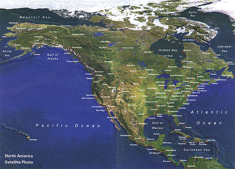 |
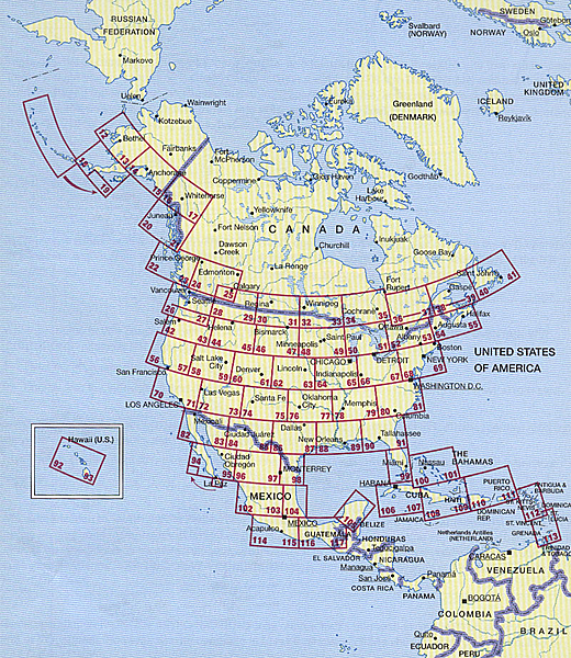
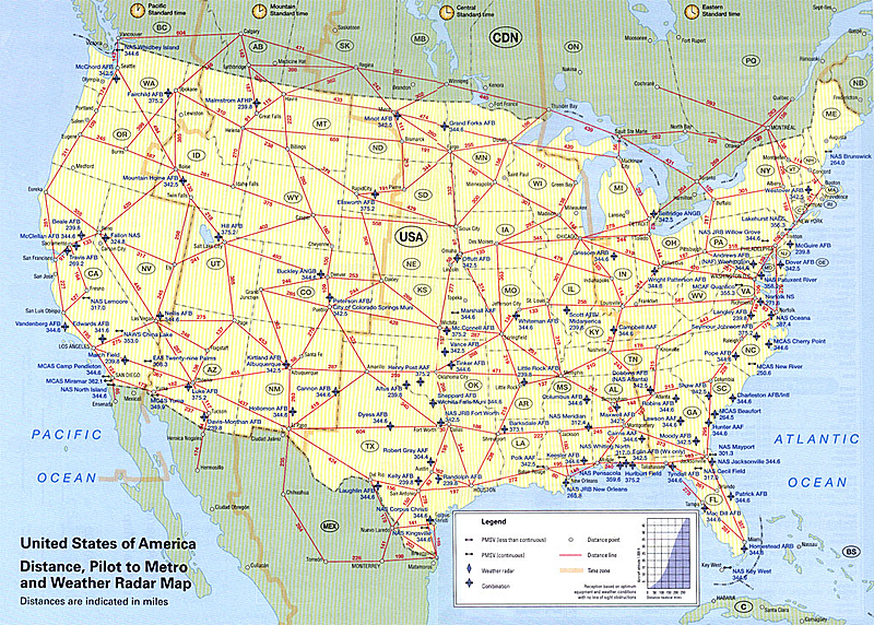
| Keymap for 106 pages cartography Scale 1:2.000.000 | Distance, Pilot Metro and Weather Radar Map | Satellite Photo |
 |
 |
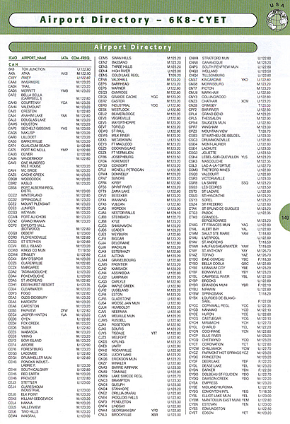 |
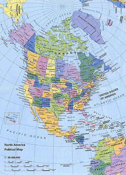
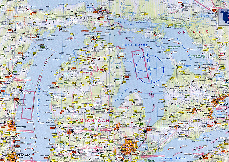
| Political Map | Sample cartography, one of 106 pages | Sample Captains Corner Airport Directory with over 5,500 airports |
 |
||
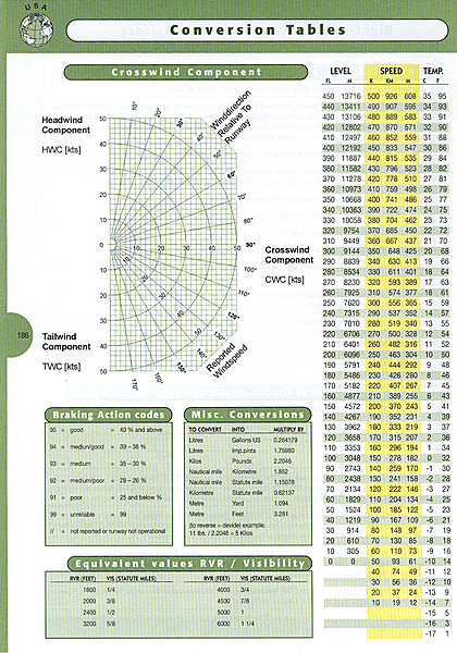
| Sample Captains Corner Conversion tables + crosswind component | ||
Datas
| Size: | DIN A 4 (202 x 292 mm), 192 Pages, 4-colour |
| Papper Quality: | Cover: 250 g/qm, wood-free, Glossy, |
| Contens: 65 g/qm, wood-free Matt | |
| Cover: | Clear foil laminate, Simi -Gloss |
| ISBN-Code: | 3-00-005893-1 |
| EAN-Code: | 9 783000 05893-1 |
| Weight: | ca. 425 g |
| Suggested retail price: | 29,99 EUR, incl. 7% german VAT |
| Publisher/Copyright: | absoluteZero multimedia GmbH, 63533 Mainhausen, Germany |
| Flight data: | Jeppesen & Co. GmbH, D-63263 Neu-Isenburg |
| Printed by: | Neef & Stumme GmbH & Co. KG, D-29378 Wittingen |
| Coverage: | USA, south Canada, Mexico, Caribic and Vigrin Islands |
| Maps: | 104 Pages, Scale 1:2.000.000 |
| Citymaps: | 30 pages City maps, Scale 1:20.000 |
| Captains Corner: | 46 pages |
| The last 46 pages we call the "Captain’s Corner". This is a collection of useful information. Categories include: World Aircraft Registrations, Airport Signs, Conversion tables, Abbreviations, Weather, Emergency Communication, Search and Rescue and Intercept Procedures. we have also created a new "Airport Directory" including ICAO & IATA Codes, with airport name and WX Radar, FIS freq. | |
| Description: | Base cartography is the US Road-Atlas 1: 2.000.000 which includes mountain ranges, lakes, rivers, etc. . As well, all other elements such as, cities, towns. Parks and points of interest or historic value and of course, the railways and motor-ways themselves. To this , we have added all airports in USA (over 5,500) and colour coded them by runway length /surface and category ,ie. International, Regional, Civil/Military, etc.. VOR/DME , Reporting points, Waypoints), Volmet frequencies and special Use Airspace are also shown making our new „Pilots´ Atlas“ the first of it’s kind. |
Subcategories
Atlas USA/Canada & Mexico - samples -
Atlas USA/Canada & Mexico- samples